Here's something new:
Road race today reminded me of the Tour of Poland; cold and rainy. 55 degrees with rain throughout and strong winds. It was miserable, but I switched my brain off after a while. Then the cold caught up to me and I switched my brain back on and was miserable. But I had made a little early-race selection, so I had to stay with it. Came down to a sprint. My body had spent too much time keeping itself warm and didnt have anything left at the end, despite the ride being easy on the legs. I don't know where I was. Maybe 10th or so? Hard to tell.
I thought about quitting. But that would dishonor my mustache and cycling cap.
Street Sprints later. I'll do them if they happen. Must honor the stache. Crit tomorrow. Same weather as today. I anticipate a lot of crashes.
Thank you for reading the most boring race report this blog has ever bequeathed to the populace.
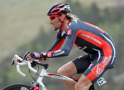
You know what? I'm feeling generous, here's a photo of Vladimir Karpets:
17.4.10
4.3.10
Sorry folks
Tales from the Peloton has been banned by the UCI.
I enjoyed it, other people enjoyed it, but I haven't the time anymore.
10.1.10
Guest-Blogging
None are worthy enough to guest-blog on Tales From The Peloton.
But TFTP might have done a little guest-blogging over on Texas Cycling.
9.1.10
Cycling in Townsend and The Smoky Mountains
A recent winter trip to Tennessee found me in Townsend with a bike and spare time on my hands. Here's a list of my ride reports:
Rides 1 & 2 - Cades Cove
Ride 3 - Foothills Parkway and Tail of the Dragon
Ride 4 - Wears Valley to Pigeon Forge
I found the Tail of the Dragon site very useful in learning about that ride, and it also gave me info on the Cherohala Skyway, a bit further away, but a ride which I'll have to do at some other point. Had there not had been heavy snow just before we got there, I probably also would have ridden up to Clingman's Dome.
Rides 1 & 2 - Cades Cove
Cycling in Cades Cove starting at The Y and ending in Townsend
Ride 1 - aborted Cades Cove ride.
The heavy snow over the weekend meant that the road up to Cades Cove was closed, so my dad and I got dropped off and took our bikes up it.
There was snow in abundance so everything looked nice and the road was closed to cars, so it was very pleasant despite being freezing or so.
We saw a snow plow and a park ranger coming down the other way and gave them a slight wave which was entirely unreciprocated. Unfortunately, the ranger turned around and told us that the route was closed to bikes as well as cars, so that we wouldn't get hit by snow falling off of tree limbs. We turned around, went downhill, got very cold, left the park, remained very cold, and called in a pick up so we'd stop freezing.
Ride 2 - Cycling Cades Cove, successful this time
This time we actually made it into Cades Cove. See map here.
It was nice and scenic with the dusting of snow that remained, but still with bunches of cars, who often slowed us down. During the summer months they close Cades Cove off to cars Wednesday and Sunday mornings, in which case you'll be slowed down by people on hybrids rather than cars.
Getting over the cars though, and passing over the idea that me getting frustrated by having to slow down for cars is like cars having to slow down for me, it was a nice ride though.
Ride 3: Foothills Parkway and Tail of the Dragon
Cycling in Townsend and the Smoky Mountains
Ride 3 - Foothills Parkway and Tail of the Dragon
Cycling through Foothills Parkway and then the Tail of the Dragon, one of the hardest and most rewarding rides I've done.
See map here.
My ride started out with getting dropped off at the base of the Foothills Parkway. From there, it's a nice and steady three mile climb before the road levels out for a bit and then continues going uphill. I've always thought though that only by climb could you really see nice sights, and there was no shortage of them on Foothills Parkway, with the Smoky Mountains to the east and a large view of flat land to the west.
At the top of the climb, there's a large parking lot with a scenic view and a ranger station nearby.
From there, it's a good 8 miles of downhill until you reach 129 and take a left towards North Carolina. Chilhowee Lake will be on your right side, something which I had overlooked in planning the ride, so it was a nice surprise.
Tail of the Dragon will start after about three miles cycling along the lake. This rather obvious sign will let you know when it starts.
The following 11 miles are some of the curviest in the world, and much loved by motorcyclists and cyclists alike.
Tail of the Dragon isn't just a single climb, but a couple smaller uphills and downhills. The climbs are enjoyable, and the descending it fantastic. There are certainly some technical parts to the descents, but nothing too challenging. What's nice is that the car speed limit here is 30 mph, so there isn't much of a risk of cars blowing by and they can be dropped when going downhill.
It's hard to get one image to encapsulate the curviness, because a single image can't well represent how unrelenting the curves were for 11 miles. Well, 22 miles after I turned around at the North Carolina state line and did it all the other way.
Going back through the Dragon was fun, but climbing up Foothills Parkway again about did me in. It's a good 8 miles which barely levels out, and while I enjoy climbing, that's just not something we get in Texas. I suffered up the 8 miles and called in a pick up at the end of the Parkway because I didn't feel like going the added six miles. For getting to and from Foothills Parkway from Townsend though, the Old Walland highway is superior in every respect to cycling on Lamar Alexander.
And for those who would rather suffer several miles of climbing rather than 8, return via Happy Valley rather than Foothills Parkway; it's crams 8 miles of climbing into less than 3.
For more Tail of the Dragon info, this site can't be beat for being informative and interesting. Unfortunately, the store at Deals Gap is closed during the winter, otherwise I would've got myself a nice airbrushed motorcycle shirt.
Ride 4 - Wears Valley to Pigeon Forge
Cycling in Townsend and the Smoky Mountains
See map here.
My ride started out with getting dropped off at the base of the Foothills Parkway. From there, it's a nice and steady three mile climb before the road levels out for a bit and then continues going uphill. I've always thought though that only by climb could you really see nice sights, and there was no shortage of them on Foothills Parkway, with the Smoky Mountains to the east and a large view of flat land to the west.
At the top of the climb, there's a large parking lot with a scenic view and a ranger station nearby.
From there, it's a good 8 miles of downhill until you reach 129 and take a left towards North Carolina. Chilhowee Lake will be on your right side, something which I had overlooked in planning the ride, so it was a nice surprise.
Tail of the Dragon will start after about three miles cycling along the lake. This rather obvious sign will let you know when it starts.
The following 11 miles are some of the curviest in the world, and much loved by motorcyclists and cyclists alike.
Tail of the Dragon isn't just a single climb, but a couple smaller uphills and downhills. The climbs are enjoyable, and the descending it fantastic. There are certainly some technical parts to the descents, but nothing too challenging. What's nice is that the car speed limit here is 30 mph, so there isn't much of a risk of cars blowing by and they can be dropped when going downhill.
It's hard to get one image to encapsulate the curviness, because a single image can't well represent how unrelenting the curves were for 11 miles. Well, 22 miles after I turned around at the North Carolina state line and did it all the other way.
Going back through the Dragon was fun, but climbing up Foothills Parkway again about did me in. It's a good 8 miles which barely levels out, and while I enjoy climbing, that's just not something we get in Texas. I suffered up the 8 miles and called in a pick up at the end of the Parkway because I didn't feel like going the added six miles. For getting to and from Foothills Parkway from Townsend though, the Old Walland highway is superior in every respect to cycling on Lamar Alexander.
And for those who would rather suffer several miles of climbing rather than 8, return via Happy Valley rather than Foothills Parkway; it's crams 8 miles of climbing into less than 3.
For more Tail of the Dragon info, this site can't be beat for being informative and interesting. Unfortunately, the store at Deals Gap is closed during the winter, otherwise I would've got myself a nice airbrushed motorcycle shirt.
Ride 4 - Wears Valley to Pigeon Forge
Cycling in Townsend and the Smoky Mountains
Ride 4 - Wears Valley to Pigeon Forge
This ride went up through Wears Valley to Pigeon Forge, then around Gatlinburg and down Little River Rd.
See map here
I had wanted to go cycling through Wears Valley because last time we were at Townsend I recalled it being a nice drive. It's a bit more commercialized than I would have liked, but it is a nice drive. It's not too good of a bike ride though.
Going up Wears Valley from Townsend starts out with a nice little climb, then it's fast and flat or downhill until around Pigeon Forge. The road itself has no shoulder, and the aforementioned commercialization gives it heavier traffic than I would have liked.
It's a nice little valley though, with plenty of fudge stops if you're so inclined. I had intended to take a right onto Lyon Springs Road about 11 miles into the ride, but I never saw it, so I just kept going. I figured eventually I'd hit Pigeon Forge and that I could go back through the park from there. Plus, the wind was behind me and I was cruising along so fast I didn't feel like stopping.
Very much to my surprise and relief, Pigeon Forge actually had something which functioned as a bike lane, though I didn't get the feeling that that was it's intent. Despite not being entirely confident on where I was, I knew that going through Gatlinburg would be messy, but fortunately the signs for the Gatlinburg Bypass were worded obviously enough that I wound up taking it and getting into the park.
A longer than I had wanted uphill and then a quick downhill into the park and a stop at the ranger station. There's a nice climb coming out the ranger station which still had quite a bit of snow aside it.
Going down Little River Rd was less fast than I had remembered it, but I think I had a bit of a headwind. Less fast was still averaging around 26 mph though. No photos from here, as I was having too much fun going downhill.
Going downhill through the park was fun, but Wears Valley was more crowded than I would have liked, and cycling through Pigeon Forge is something I'd really only want to do again through necessity. Certainly not a ride I'll plan on doing next time I'm in the area.
Cycling in Townsend and the Smoky Mountains
Subscribe to:
Posts (Atom)